Battle Damage > 391st Bomb Group HQ & UNKNOWN
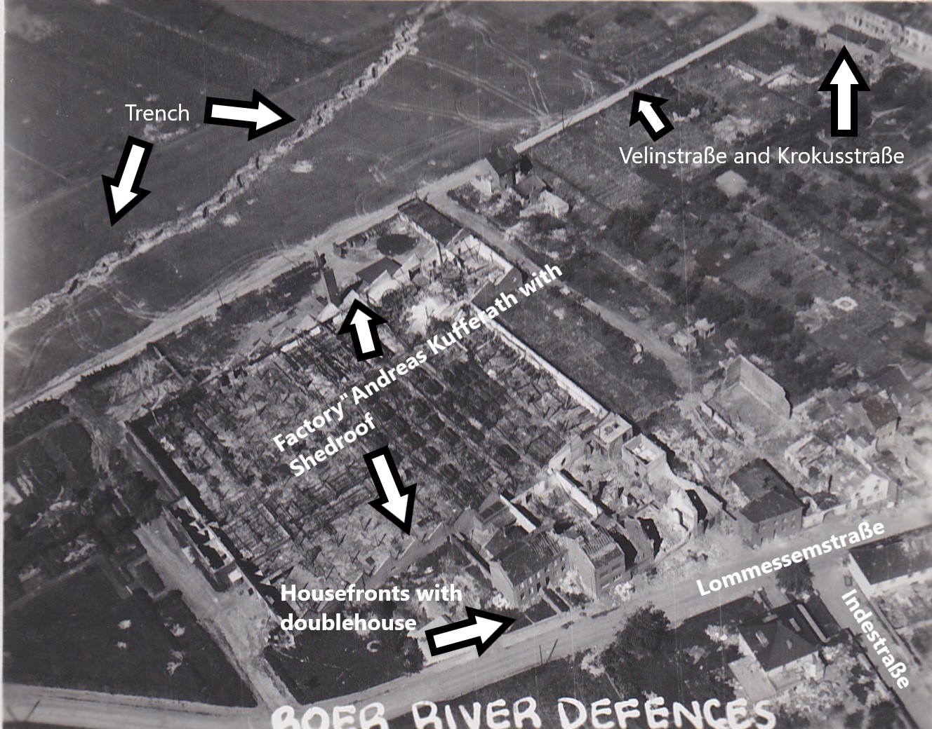
Roer River Defences #2 - annotated.
Courtesy of Joerg Pottkaemper.
Joerg Pottkaemper has provided the following information: The photo shows the ruins of the Kufferath factory at Mariaweiler, a small village west of Duren. The geodatas are 50.81336685114755N, 6.443844828560867E. You can see a trench running through the upper left quarter and a small track between the trench and the destroyed buildings. This was not an official street and more used by the local farmers - today the Velinstraße. Today the factory extends into the fields where the trench is running and all the buildings between the factory and the Lommessemstraße have been brought down for another extension. The form of the trench indicates that this was not the type soldiers would do. It is too regular and was easy to conquer in a trench fight. The small spots in the upper middle part of the image are foxholes with distances to each other like been planned on a drawboard.
Joerg Pottkaemper has provided the following information: The photo shows the ruins of the Kufferath factory at Mariaweiler, a small village west of Duren. The geodatas are 50.81336685114755N, 6.443844828560867E. You can see a trench running through the upper left quarter and a small track between the trench and the destroyed buildings. This was not an official street and more used by the local farmers - today the Velinstraße. Today the factory extends into the fields where the trench is running and all the buildings between the factory and the Lommessemstraße have been brought down for another extension. The form of the trench indicates that this was not the type soldiers would do. It is too regular and was easy to conquer in a trench fight. The small spots in the upper middle part of the image are foxholes with distances to each other like been planned on a drawboard.